Mapping
Related Episode
Denis Wood creates maps that are like novels: they try to describe everyday life. Here are some of the ones he tells us about in episode 110, "Mapping."
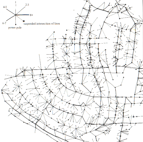
Overhead
This is a map of the neighborhood’s phone, cable, and power lines. We did a lot of walking and looking to make this map.
All maps by Denis Wood.
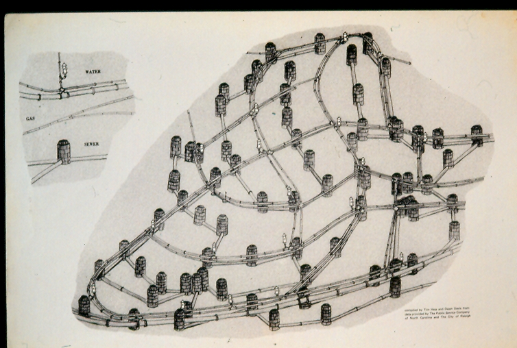
Underground
This is a map of the sewers with their manholes as well as the gas and water mains running beneath Boylan Heights. The fire hydrants, of course, are aboveground.
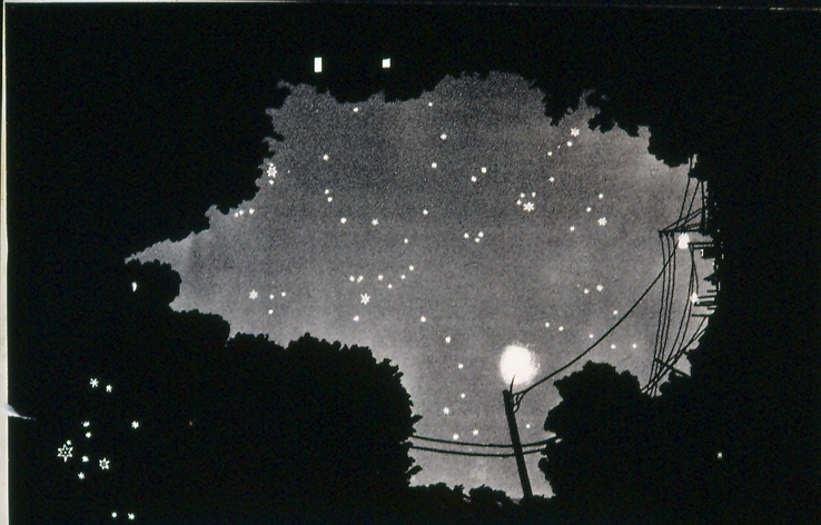
Stars
If, in the middle of a summer’s night, you were to lie down at the intersection of Boylan and Montfort Avenues and look up, this is what you’d see.
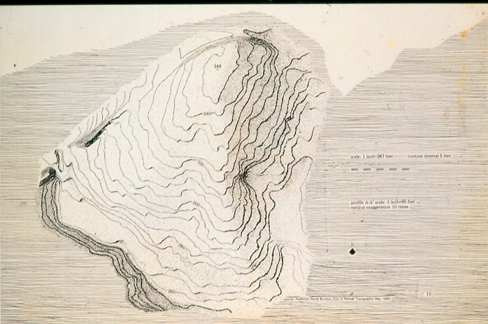
Boylan's Hill
Boylan Heights covers this hill, carved by Rocky Branch and its tributaries to the west, south, and east; and to the north by a railroad cut.
Street Lights
We stubbed a brush loaded with ink at the location of every street light in the neighborhood to suggest the pools of light you swim through walking the streets of Boylan Heights at night.
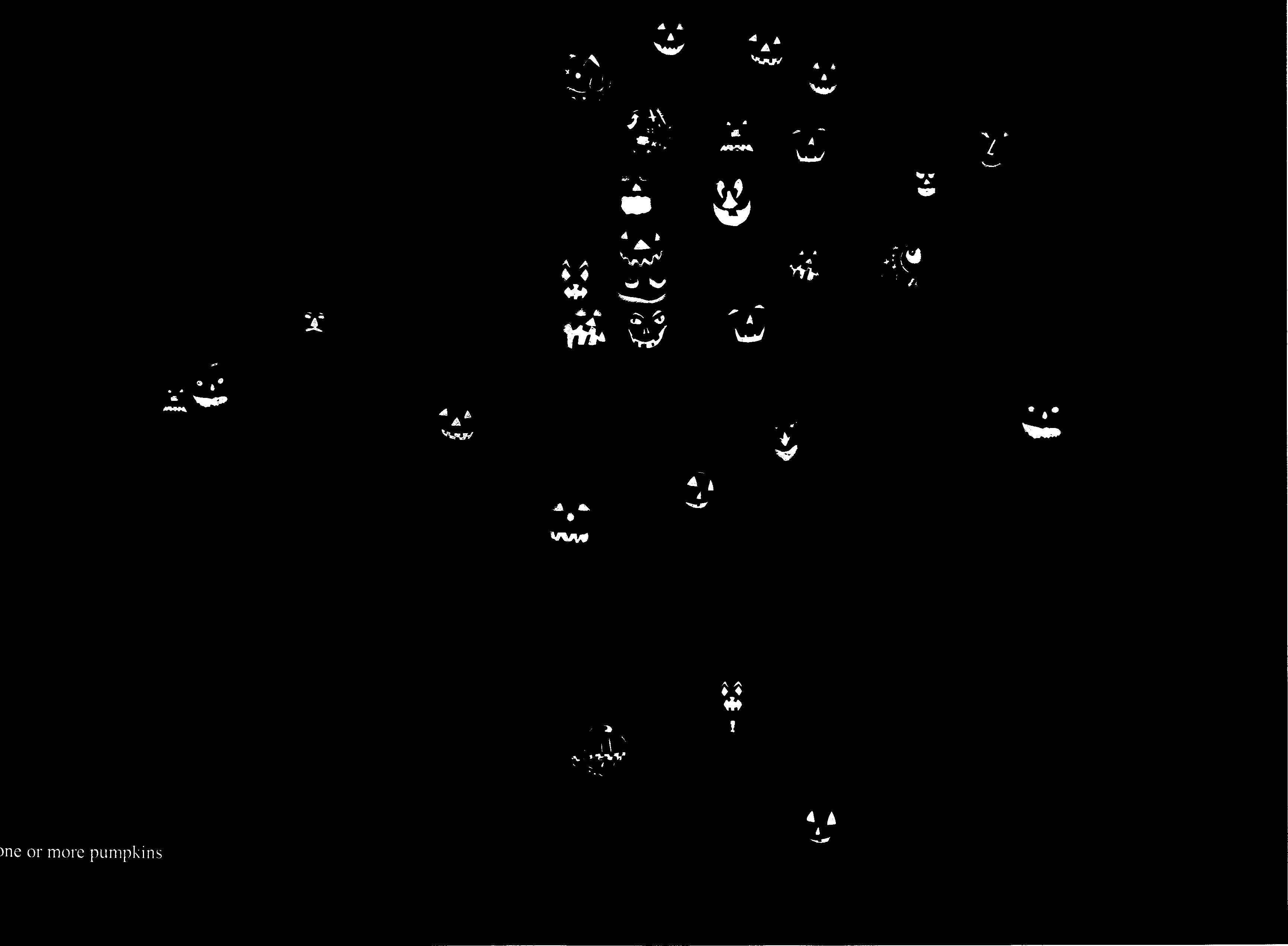
Pumpkins
On Halloween 1982, I walked around the neighborhood and photographed all the jack-o'-lanterns. In most cases, the photograph is of the pumpkin on the porch at that location, but where my photographs didn’t turn out, we duplicated an image from another porch.